

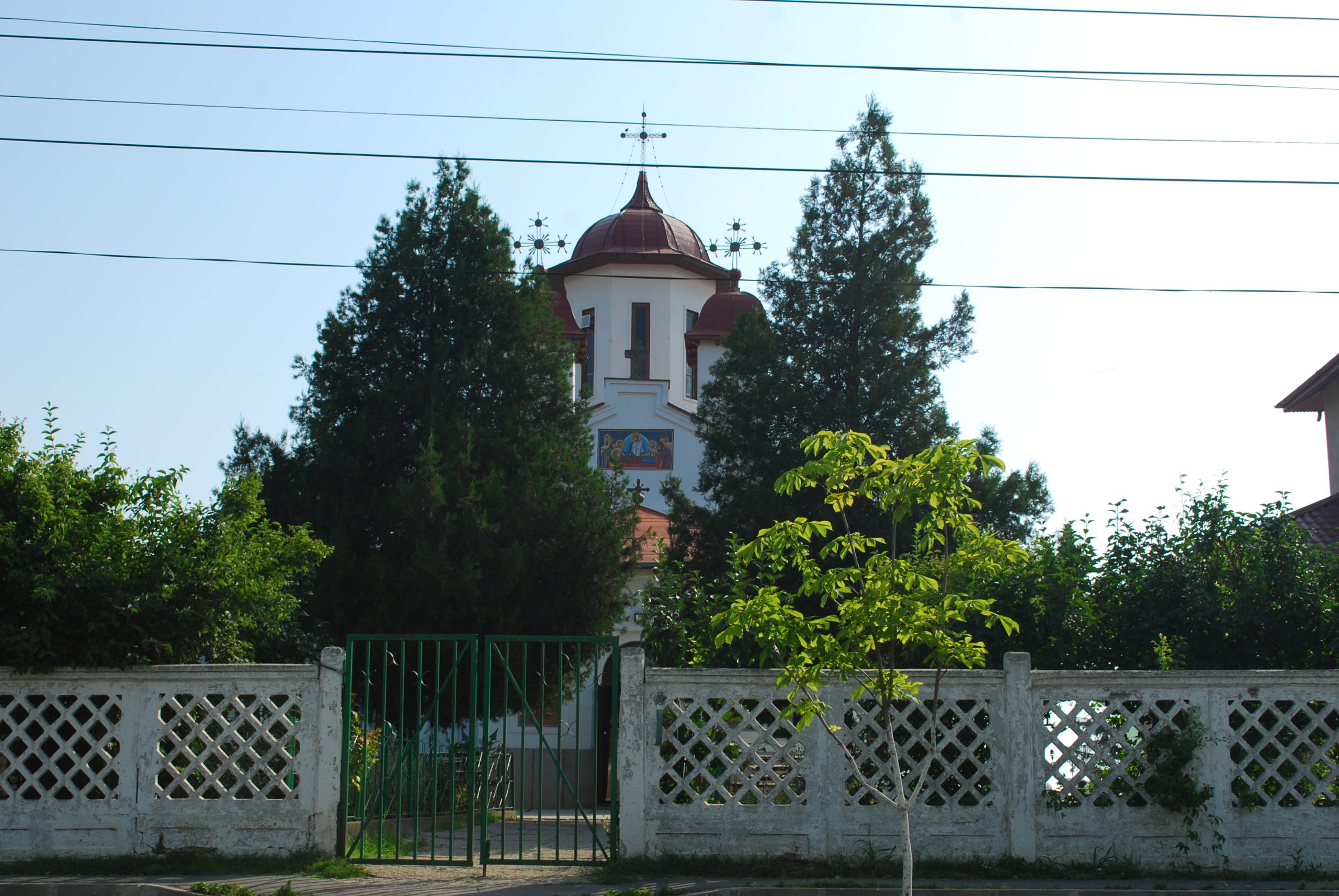

A Promontory between Two Rivers
History + fiction
Historical record
Before it was a monastery, Tânganu was a place worth choosing. A long, low promontory rose above wet ground east of Bucharest, offering firmer soil where people could live and work without surrendering their access to water. The archaeologists described the site as a spine of terrace, where Valea Tânganului met an old bed of the Dâmbovița. Marshes and standing water spread across the lower ground, while woodland closed the northern approach. At the head of the promontory lay the shallow Valea Călugărițelor, separating the inhabited tongue of land from the forest. [1] [2]
In the saga
The hidden pisanie — seven fragments by the old mill
In True Charm, as Tatar attacks force the monks to flee Tânganu, they break the founding pisanie into seven pieces and conceal the carved limestone in the marsh mud beside the old mill south-west of the monastery. Villagers and surviving clergy later recover the fragments while clearing flood debris. Teodora’s reconstruction restores the inscription, reproduced in the chapter epigraph to Harvest Command, Part XI, “Clarity”. The inscription and its recovery are elements of the saga’s fictional history.
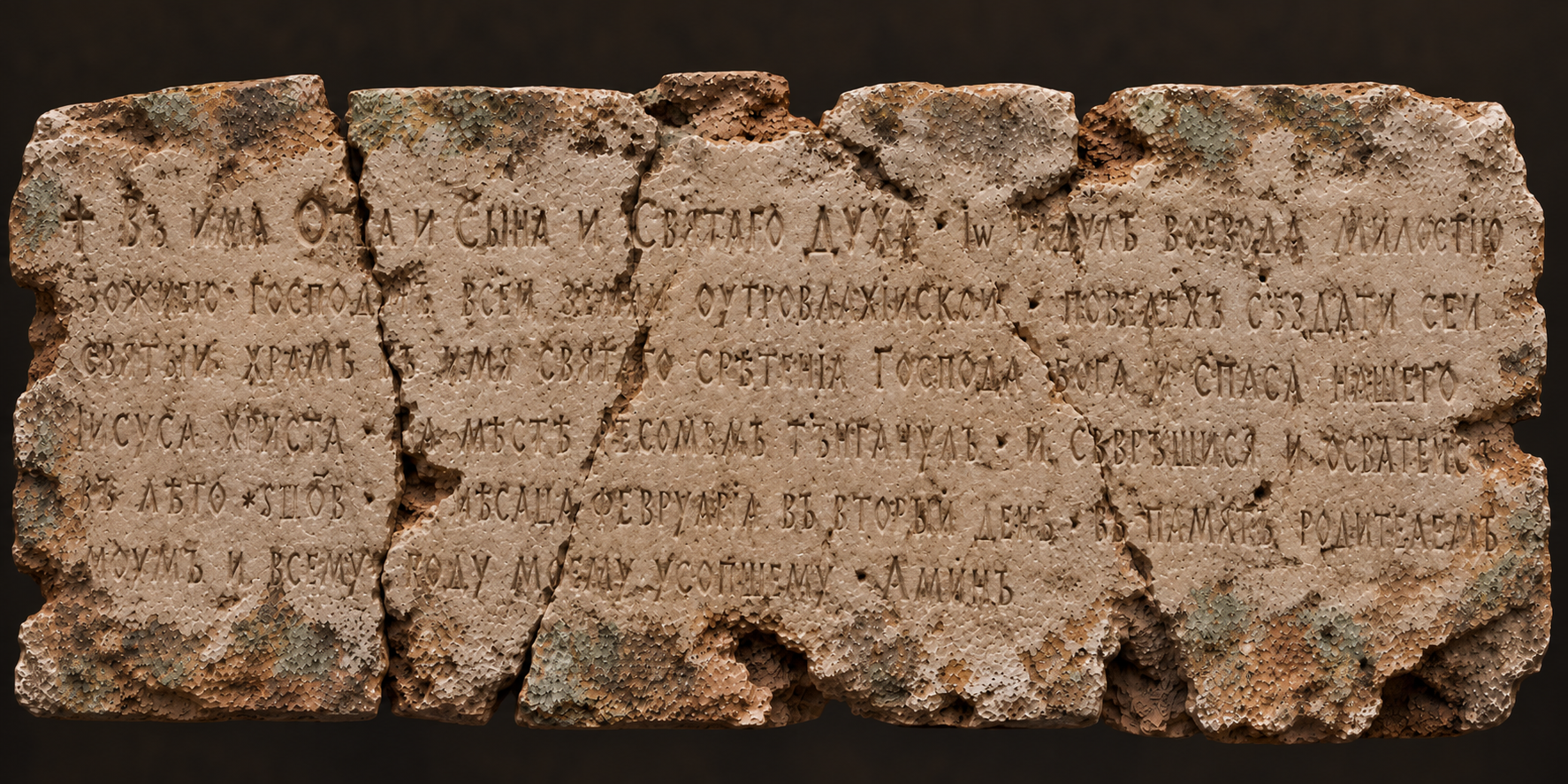
Illustration for True Charm / Vraja Adevărată · 2026
The reconstructed inscription — Slavonic, Romanian and English
The inscription below preserves the three complete versions reproduced in the manuscript.
Slavonic — the novel’s reconstructed inscription
† Въ имѦ Отца и Сына и Святаго Духа · Іѡ Радулъ воевода милостію Божіею господинь всеи земли Оугровлахїискои · повелѣхъ създати сеи святыи храмъ въ имя святаго Срѣтенїа Господа Бога и Спаса нашего Іисуса Христа · на мѣстѣ рекомѣмь Тънганулъ · И съвръшися и освѦтися въ лѣто ҂ѕцо҃в · мѣсѦца февруарїа въ вторыи день · въ память родителемъ моимъ и всему роду моему усопшему · Аминь
Romanian — manuscript rendering
„† În numele Tatălui și al Fiului și al Sfântului Duh.
Eu, Radu voievod, din mila lui Dumnezeu domn a toată Țara Românească, poruncit-am să se zidească această sfântă biserică întru numele sfântului praznic al Întâmpinării Domnului Dumnezeu și Mântuitorului nostru Iisus Hristos, pre locul ce se cheamă Tînganul. Și s-a săvârșit și s-a sfințit în leatul 6972, luna lui februarie, în ziua a doua, spre pomenirea părinților mei și a tot neamul meu adormit. Amin.”
English — manuscript rendering
Ҡ In the name of the Father, and of the Son, and of the Holy Spirit.
I, Radu, Voivode by the grace of God and lord of all the land of Wallachia, ordered this holy church to be built in honour of the holy feast of the Meeting of our Lord God and Saviour Jesus Christ, at the place called Tânganu. And it was completed and consecrated in the year 1464, on the second day of February, in memory of my parents and all my departed kin. Amen.”
In the novel, the inscription bears the date 2 February 1464 and the patron’s name Radu. The established archaeological studies identify his foundation but do not document this reconstructed pisanie.
Historical record
This landscape belonged to the broader meeting-place of two rivers. The Colentina joins the Dâmbovița in the Cernica area, a district of river terraces, former channels, meanders and floodplain. The medieval monastery’s particular position was by the old Dâmbovița course and Valea Tânganului; another archaeological site, Tânganu–Autostradă, lies on an old Colentina terrace close to the two-river confluence. The neighbouring sites reveal different parts of the same attractive terrain. Modern embankments and the chain of lakes along the Colentina have considerably altered the waterways seen today. [5] [6]
In the seventeenth century the place could feel almost island-like. On 5 September 1657, Macarios III, Patriarch of Antioch, came with his son, Paul of Aleppo, and their companions. Paul described crossing by boat to an old monastery encircled by a broad lake. The water was both approach and protection. There was no imposing defensive circuit around Radu cel Frumos’s foundation: archaeologists found neither a surrounding fortress wall nor a defensive ditch. Water, marsh and forest made the position naturally difficult to attack. [2] [3]
The same geography offered everyday advantages. Higher ground gave a dry home; wet meadows and waterside vegetation lay below; the nearby waters held fish, while fields and grazing land could support crops and livestock. The surviving traces of prehistoric and medieval households show that different communities recognised these possibilities over many centuries. To picture medieval Tânganu is to imagine a small church and modest buildings on a green rise, with water, reeds and trees beyond them—not a walled abbey isolated from its countryside. [2]
The photograph below shows Lake Cernica within the modern Colentina landscape. It offers a view of the waterways and wooded margins that still characterise this part of Ilfov, even though the medieval channels and lake margins have changed.
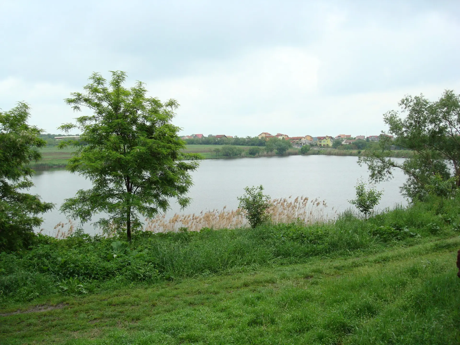
Lake Cernica, photographed in May 2008. The neighbouring wetlands and woodland help convey the water-shaped landscape east of Bucharest.
Documentary photograph of Lake Cernica, May 2008 · Source: Cernica landscape collection
The Medieval Monastery Takes Shape
Historical record
Radu cel Frumos founded his monastery in the fifteenth century, probably during the 1460s. The original church rose on the promontory in river stone and brick, with a trefoil plan and a single tower. Its dedication was to the Meeting of the Lord, known as Stretenia or Întâmpinarea Domnului. The earliest surrounding accommodation was far humbler than the church: timber frames coated with clay, earth-sunken dwellings, domestic yards and rooms made for ordinary monastic work. The excavators suggested that the position could also have suited a princely stopping-place on Radu’s journeys towards the Danube. [2] [3]
To understand the ruins it is essential to follow their order. The first abbot’s residence stood around ten metres south of the church’s southern apse. Its burnt timber and clay remains were associated by the excavators with the Ottoman invasion of August 1595. The monks then built a second residence some twenty metres south-east of the church, again largely of timber and clay. Beneath it was a cellar covering more than 56 square metres. Fire engulfed the house during the devastating attacks of 1658–1659; fallen oak beams, planks and fragments of burnt walling filled the abandoned cellar. These were changes in the position of the household, not the growth of three simultaneous residences. [2]
Recovery brought a more substantial brick abbot’s residence back onto the first southern site. In its initial form the building measured about 15 by 6.5 metres, with a raised ground floor over two unequal cellars: a western room of 19.5 square metres and an eastern room of 74.75 square metres. A north-facing sloping entrance passage, roughly three metres wide and five metres long, approached the larger cellar from the direction of the church. An internal doorway connected the two rooms. Later work strengthened the supports of the vaulted ceilings, created another room and added a stairway to the raised floor. [2]
By the later seventeenth century the church had also acquired an outer narthex, while the residence underwent further repairs associated in the report with the period of Constantin Brâncoveanu. Another serious fire eventually ended the brick house’s use in the early eighteenth century. The archaeological plan records stonework and traces from several periods together; in life, these buildings rose, burned, changed position and were rebuilt across generations. [2]
Tânganu through time
Three artist’s impressions compare the foundation phase (c. 1464), the monastery at Paul of Aleppo’s visit (1657), and the rebuilt complex (c. 1700). The building sequence follows the archaeological record; precise roof forms, secondary buildings and medieval shorelines remain interpretative.
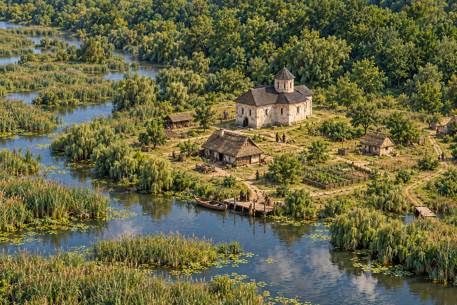
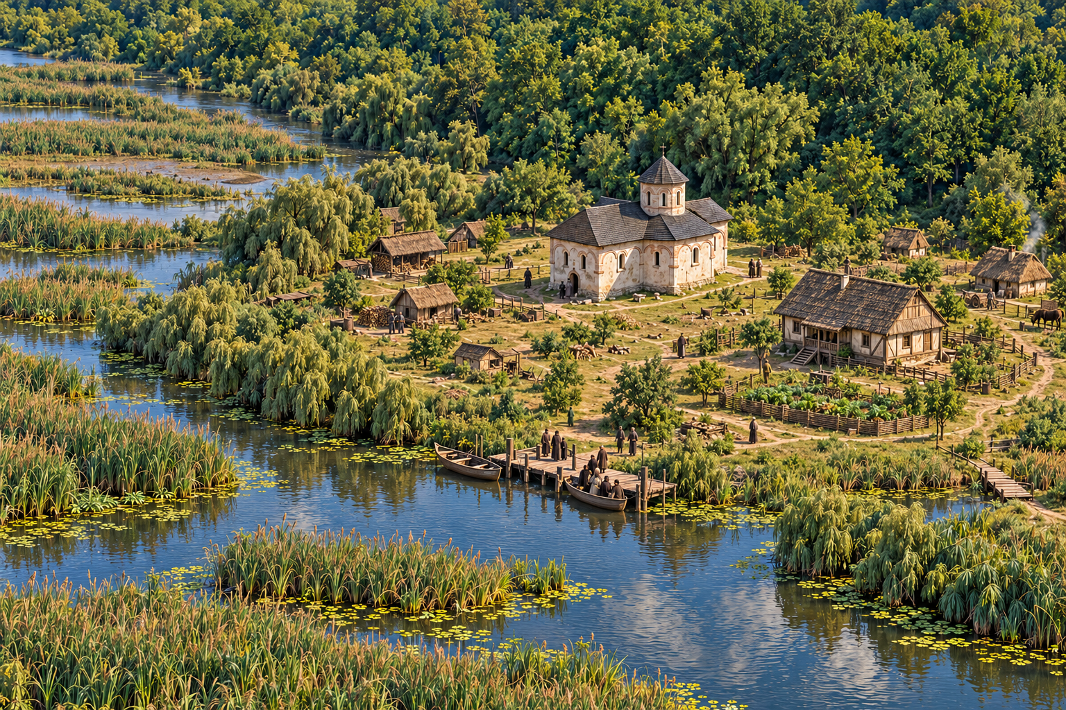
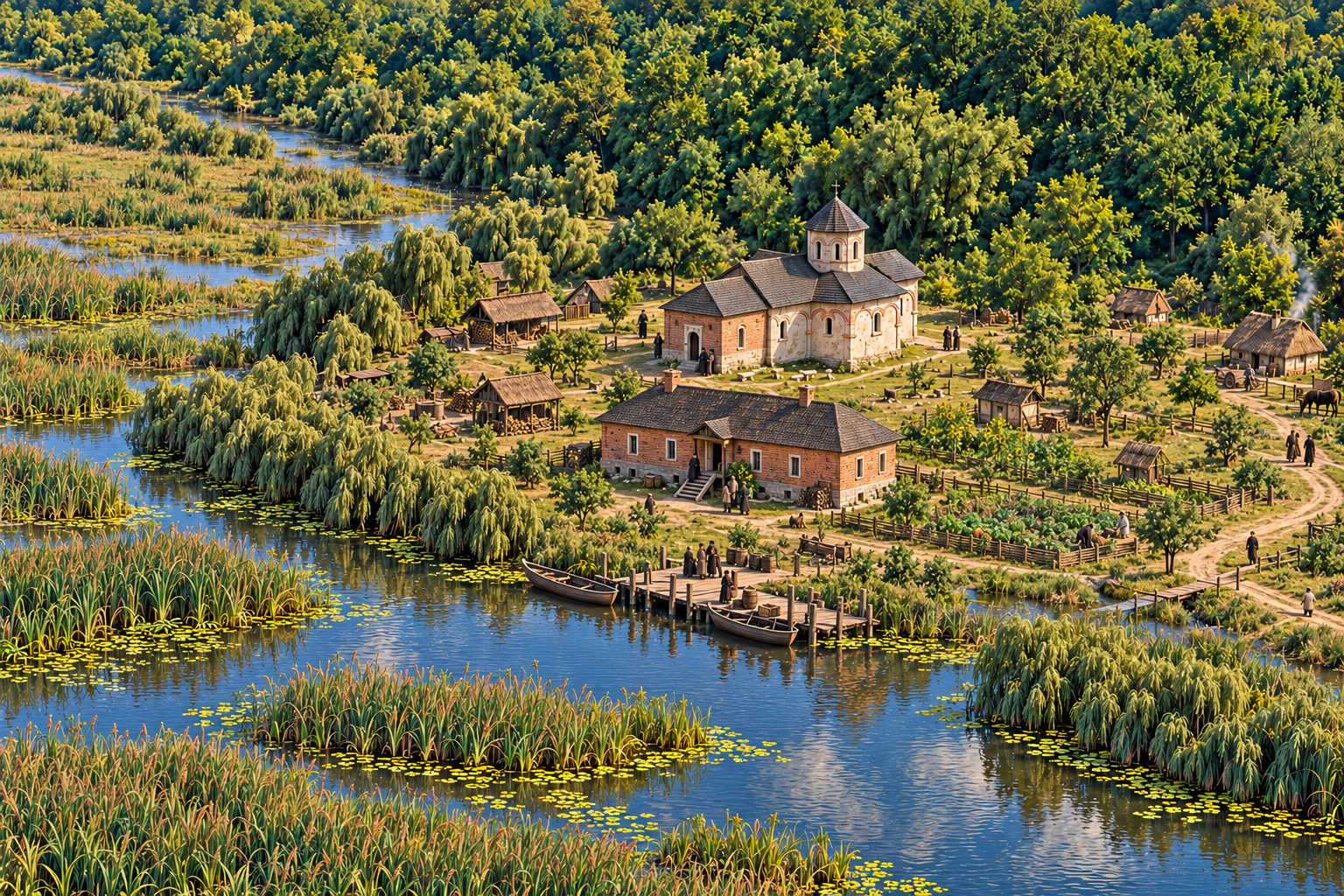
AI-assisted artistic reconstructions for True Charm / Vraja Adevărată · 2026
The plan reproduced below makes the sequence tangible. The church is the point of reference; the abbot’s household moves south, then south-east, before returning south in brick. A landscape of water and woodland remained around each successive arrangement.
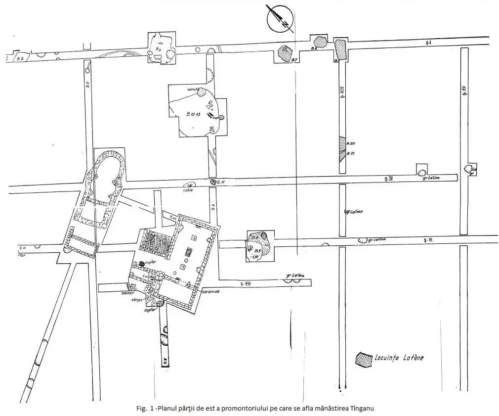
Archaeological survey plan of the Tânganu monastery: traces from successive construction phases are recorded together. The positions of the residential buildings changed over time.
Archaeological plan: Tânganu excavation documentation · Reproduced from the historical site record
Ancient Families, Monks and the Nuns of Iezeru
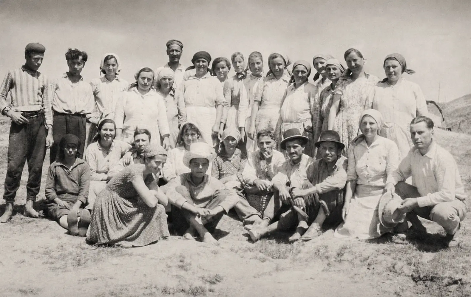
Researchers and workers at the 1964 archaeological campaign at Tânganu, whose excavations helped recover evidence of the monastery and the ancient settlement beneath it.
Archival photograph: the 1964 excavation at Tânganu · Archaeological documentation